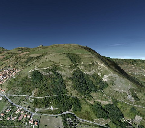
Plateau de Gergovie, Puy-de-Dôme, France

Located on the boundary between the Dômes plateau and the Limagne plain, the Gergovie plateau, once the seat of the terrible Gallo-Roman battle, is a truly very interesting site from a geological point of view since the structures of three maars there are observable in addition to the classic inversion of relief. It should also be noted the mineralogical and paleontological riches that have been extracted from it over the last decades... Today, as the site is protected, it is forbidden to prospect there.
Geological history of Gergovie :
In the Oligocene, marl-limestone sediments were deposited in a lake environment. These carbonate layers, locally rich in fossils (snails, limnaea, reptiles, mammals), will constitute the bedrock of more recent eruptive events. Indeed, magmatic intrusions in non-diagenized sediments generate violent phreatomagmatic activity causing a first maar (explosive reaction following the magma-water encounter). Some magmatic rises do not reach the surface and locally form sills and dykes. The explosion crater will be covered by peperitic deposits (volcano-sedimentary breccia) from this same eruptive phase. A cessation of volcanic activity caused the establishment of lake sediments in the Lower Miocene.
At the same time, a second eruptive phase of the same type as the first, will generate a second maar more or less matching the shape of the first, a new explosion crater is created and filled by the fragmented material of the eruption. Once the volcanic activity is over, the depression will be filled by other marl-limestone formations.
At the end of these events, two lava flows will cover the entire structure, one is dated at -19 MY and the second at -16 MY. These flows will play a role of protective shield against erosive phenomena, avoiding the disintegration of the underlying more or less carbonate formations. Erosion will sculpt the landscape for 16 million years until today where the flows culminate at more than 700 m and constitute the summit of the Gergovie plateau, a plateau known as "relief inversion".
Mineralogical and paleontological riches :
The Gergovie plateau is not only renowned for its ancient remains, it is a site known and recognized by mineralogists since it locally contains high quality opal (today completely untraceable), zeolite clusters, as well as a highly prized vacuolar basalt with aragonite urchins and calcite balls. These mineralizations are secondary and come from fumarolic emanations (volcanic gases) and late hydrothermal circulations.
When it comes to fossils, the Gergovie site also yielded interesting specimens; the Chattien marl-limestone bedrock is locally very fossiliferous, it was extracted from freshwater molluscs (planorbs, limnaea, snails) but also from vertebrates (birds, turtles, crocodiles, mammals)... Under the two lava flows , these are Aquitanian sediments which are present, these are broken up into plates which can be very fossiliferous, more than 60 tropical plant species have been recorded there with also an interesting fauna in lake molluscs!
References :
Guide des Volcan d'Europe et des Canaries - KRAFFT M.


